
Knocknaskereighta [Sceithigh Riabhach]
Good walks are even better shared.
Overview
Knocknaskereighta [Sceithigh Riabhach]
Knocknaskereighta, standing proud at 505 meters, is part of the beautiful Knockmealdown Mountains in County Tipperary.
Geology
This mountain is primarily composed of granite and sandstone, which gives it a robust look that could easily intimidate less seasoned hikers. Thanks to the glacial activity in the area, expect to see remnants of past ice flows in the form of impressive rock formations and varied terrain.
Route Information
The recommended route, the Knocknaskereighta Loop, spans approximately 8.5 km and requires around 3.5 hours to complete. Rated as moderate, it offers a good workout without being overly taxing. The trail begins at a layby off the R668, so don’t forget to park responsibly and avoid blocking any local sheep!
Features and Terrain
Summit features include a dignified cairn and a trig point, where you can rest and enjoy panoramic views worthy of an Instagram post. As for the terrain, you’ll find a combination of rocky paths, grassy patches, and the occasional muddy section, providing just the right amount of adventure.
Views
From this lofty perch, discover views that stretch across the landscape, with the Slieve Bloom Mountains glistening invitingly to the north. Late spring or early autumn is the best time to drink in the sights—just keep an eye on those clouds, as they have a reputation for rolling in uninvited.
Hazards
While an exhilarating experience, be wary of muddy patches that can appear after rain; you might feel like a racing car going off-track if you're not careful! As always, check the weather forecast, as conditions can change in the blink of an eye.
Access
The nearest parking lies conveniently close to the trailhead, making it a hassle-free start to your hike. Clogheen is your best bet for local provisions—including refreshments and perhaps a cheeky slice of cake. Public transport options are sparse, so a car is ideal for getting to the mountain.
History
The etymology of Knocknaskereighta adds a fascinating layer of history. Its name suggests that it has been a site of caution throughout the ages—if only rocks could talk! The mountain’s cultural significance is evident in the tales locals still recount today.
Knocknaskereighta is not just a hike; it's an adventure rich with stories, vistas, and the occasional muddy boot. So lace up your hiking boots and get ready for a day of exploration—but don't forget to take a moment to marvel at the beauty surrounding you!
Happy hiking!
Explore routes near Knocknaskereighta [Sceithigh Riabhach]
Public walks starting within 80 km of this hill. Nearby does not mean a route reaches the summit; check its map and access before setting out.
No public routes are currently listed within 80 km of Knocknaskereighta [Sceithigh Riabhach] on Walkmates. This does not mean there are no paths here. Explore the map and check local access information before planning a walk.
Route planning notes
These notes describe possible approaches, not verified navigable routes or permission to cross land. Check current paths, local access rules and conditions before setting out.
Knocknaskereighta Loop
A scenic loop trail starting from the nearby road, offering breathtaking views as it winds around the mountain.
Make a day of it, together
Find someone to share the walk with, or organise a day out along a route you like.
Hill facts and local notes
Classifications
Elevation
397m
1,302 ft
Prominence
280m
Coordinates
51.8690, -10.3136
V407710
OS Map
83
At the Summit
The summit boasts a prominent cairn and a trig point, providing a perfect spot for summiteers to take a snap and catch their breath (or perhaps just admire the view while pretending to be hard at work!).
Terrain & Geology
The area is primarily composed of granite and sandstone, creating a rugged landscape with stunning rock formations and unique geological features. The glacial history of the region has left its mark, with evidence of erosion and glacial deposits.
Views & Scenery
From the summit, hikers can see the majestic Slieve Bloom Mountains to the north, the rolling hills of Tipperary and even the far-off Knockmealdown Ridge on a clear day. Pack your camera!
History & Heritage
Name Origin
The name 'Knocknaskereighta' translates roughly to 'Hill of the dangerous place' in Irish, which sounds ominous, but don’t worry, it’s safer than it sounds!
Historical Significance
The mountain holds cultural significance for locals, and it is surrounded by rich folklore and stories passed down through generations.
Getting There & Facilities
Check current local access restrictions, parking rules and transport timetables before travelling. These notes do not confirm public access to the summit.
Parking
Parking is available at a small layby off the R668 road, just a short distance from the trailhead.
Public Transport
Public transport is limited; the nearest bus services operate from Clonmel. It's advisable to check local schedules.
Nearby Facilities
Amenities in Clogheen include local cafes, pubs, and public toilets, perfect for a post-hike pint or a bite to eat after your adventure.
Safety Information
Known Hazards
- Muddy patches after rain can make the trails slippery, so tread carefully! Also, like many wild places, be mindful of sudden weather changes.
General Safety Tips
- Check weather conditions before setting out
- Carry appropriate clothing and equipment
- Let someone know your planned route
- Take a map, compass, and GPS device
- Carry emergency supplies: food, water, first aid kit, torch
Hills
Some common questions about the hills answered
Are there group walks up Knocknaskereighta [Sceithigh Riabhach]?
Many walkers use Walkmates to join or organise walks with others. You can check for group walks around Knocknaskereighta [Sceithigh Riabhach] through the maps
Are there other walkers around Knocknaskereighta [Sceithigh Riabhach]?
Activity varies by location and time, but Walkmates lets you see whether others have shared walks or shown interest in this area. Find other people through the walking friends search walking friends for Knocknaskereighta [Sceithigh Riabhach] search or of course create your own walk for Knocknaskereighta [Sceithigh Riabhach]
Can I organise a walk to Knocknaskereighta [Sceithigh Riabhach]?
Yes. If there aren’t any walks listed already, you can create a walk and make it available for others to join.
If you're signed up to Walkmates, you can create a walk to Knocknaskereighta [Sceithigh Riabhach].
How do I find a walk up this hill?
There are often multiple ways to walk this hill, depending on experience and route preference. Walkmates helps you explore walks and routes that others have shared.
Can I suggest a new route up Knocknaskereighta [Sceithigh Riabhach]?
Yes. You can suggest or create routes to share with others. Walkmates focuses on the social side of walking, so routes are used to help people organise walks and explore areas together, rather than as detailed navigation tools or route libraries.
Other uses really appreciate knowledgeable walkers sharing their routes. Share your favourite route to Knocknaskereighta [Sceithigh Riabhach] here
The is an error or something incorrect about this hill. How do I let you know?
We always strive to keep the information on Walkmates as accurate as possible. If you find an error, please let us know through the contact form and we'll aim to correct it as quickly as possible
Community Discussion
Comments
Location
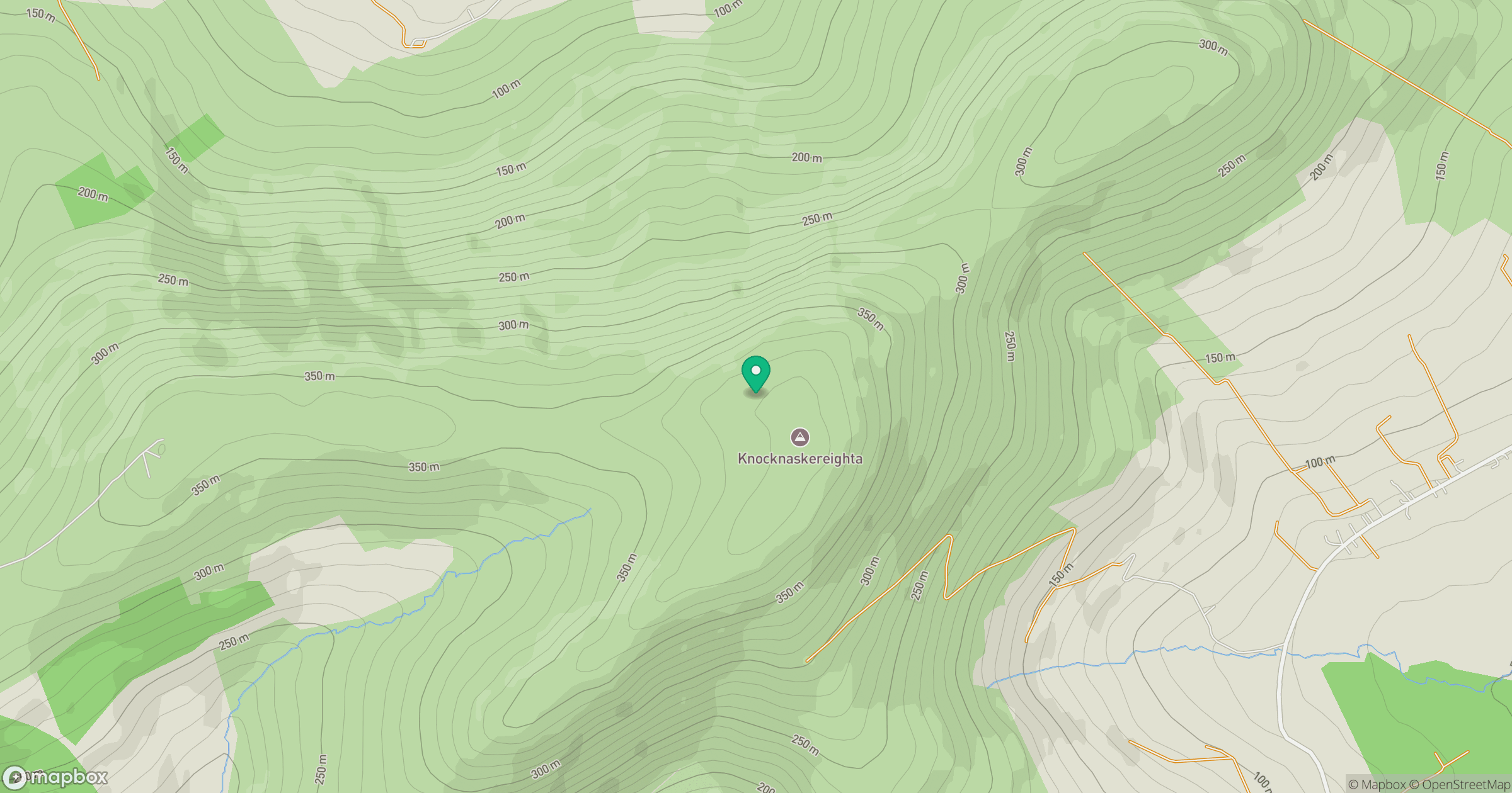
Grid reference: V407710
View on OpenStreetMapOpens a map in a new tab, centred on the hill.
Hills within 30 km
Straight-line distance, not a walking route or confirmation of access.
No comments yet. Be the first.